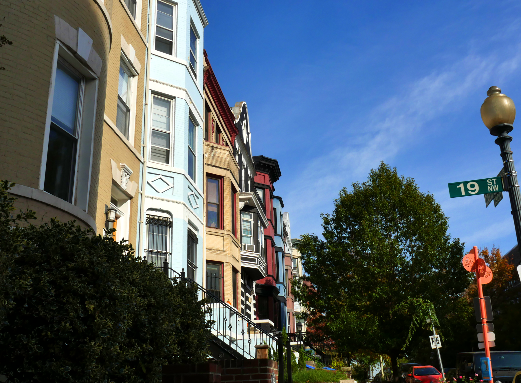
Adams Morgan Neighborhood
Fun, brash and frenetic by night, funky and colorful by day, bohemian Adams Morgan is never boring.

With its Victorian homes, funky shops and eclectic buzz, Adams Morgan is a whirl of sights and activity. Adams Morgan is characterized by a mix of historic charm and contemporary living. The streets are lined with a diverse array of architectural styles, including charming row houses and converted condos. The neighborhood maintains its historic appeal while offering a mix of modern development and innovative retail.
The demand for real estate in Adams Morgan is driven by its central location, providing residents with easy access to cultural amenities, nightlife, and public transportation. The Adams Morgan market reflects the neighborhood’s popularity, and although competitive, it offers a unique blend of housing options that cater to both long-time locals and newcomers drawn to the area’s vibrant atmosphere.
Why We Love It
- Bohemian vibe
- Eclectic architecture
- Central location
- Value
Nearby
- Woodley Park
- Cleveland Park
- Glover Park
- Burleith
- Georgetown
- Dupont Circle
CAREN L
Our process was smooth and quick, and they designed a strategy and negotiated a sale well above our asking price; and a purchase price below asking – both in the same market.
Adams Morgan Market Data
Adams Morgan History
Washington Heights Historic District
The Washington Heights Historic District is located in the Adams Morgan neighborhood. It includes 347 contributing properties that date from 1891 to 1950. Listed on the National Register of Historic Places in 2006, Washington Heights was a mostly white, middle-class neighborhood of single family rowhouses until the early 1920s when immigrants from Europe and Asia moved in. They started small businesses along 18th Street and worked in neighborhood embassies and homes as staff. The black population began moving into their rooming houses converted from larger homes in the 1930s, especially along Vernon Street. When white families migrated to the suburbs in the 1950s and 1960s, Latinos began moving in, taking advantage of affordable housing and work in Latin American embassies. Their population grew with political unrest in Latin American countries during the 1960s and in the 1970s they were joined by people from the Caribbean, Southeast Asia and Africa, creating today’s vibrant, multicultural neighborhood.
Kalorama Triangle
The Kalorama Triangle Historic District is located in DC’s Kalorama Heights neighborhood. Listed on the National Register of Historic Places in 2004, included on the District of Columbia Inventory of Historic Sites since 1986, it is comprised of approximately 350 contributing properties.
The Kalorama Triangle is a neighborhood within Adams Morgan, bounded by Connecticut Avenue, Calvert Street, NW and Columbia Road.
Lanier Heights
Lanier Heights is one of the early subdivisions created within the District, sited outside of the original, officially-planned City of Washington and two miles north of the White House. Lanier Heights is located within the larger, newer neighborhood of Adams Morgan. Its boundaries are considered to be 16th Street (east), Adams Mill Road and the National Zoo (west), Columbia Road (south), and Harvard Street (north). Like Mount Pleasant and Crestwood, Lanier Heights was developed from a large parcel of land granted to John Bradford in 1714. He named this tract Plain Dealing. In 1763 the parcel was acquired by Robert Peter of Georgetown, who also built the first home in Meridian Hill. The land that would become Lanier Heights was only used periodically for common farming until shortly after the end of the Civil War, when Washington started to develop rapidly. In 1883 the “Lanier Heights Subdivision” was created, planned and financed by Elizabeth Lanier Dunn and her husband General William M. Dunn. A few years later, banker Archibald M. McLachlen and biologist George Brown Goode of the Smithsonian Institution helped shape the neighborhood’s identity as a community for Smithsonian employees and other professionals in Washington. Introduction of an electric streetcar line on Columbia Road in 1897 and construction of The Ontario apartment building (c. 1902-06; converted to a co-operative in 1953) heightened the neighborhood’s profile and increased its population. As time went on, the Lanier Heights subdivision became a well-to-do neighborhood comprised of families, professionals, intellectuals, and city workers, developing in to a diverse compilation of people and cultures.
Meridian Hill
Meridian Hill Park, originally ‘Peter’s Hill’, was owned by Robert Peter, a wealthy Georgetown merchant. In 1804 President Thomas Jefferson placed a geographic marker there, centered exactly north of the White House, to establish a longitudinal meridian called the “White House meridian”. Commodore David Porter purchased the hill in 1816 and renamed it “Meridian Hill.” Porter built a huge mansion close to the marker. Its strategic location prompted the Army to seize the home and hill for use as a Civil War encampment named Camp Cameron. Meridian Hill mansion was damaged by fire following the war and was razed. The property was subdivided, with a large number of lots selling in 1887 to former Senator John Brooks Henderson and Mary Foote Henderson, who were relocating from Missouri. On the west side of newly extended 16th Street, they built ‘Henderson Castle,’ an elaborate stone home designed to resemble a castle. Mrs. Henderson cultivated friendships of members of Congress, then lobbied them to help her execute grandiose plans for the neighborhood, including an unsuccessful bid in 1900 to erect a presidential mansion there to replace the White House, and a failed proposal for the site to be used for the planned Lincoln Memorial. She finally pushed for a park and personally paid for the construction of a string of elaborate mansions and embassies lining 15th and 16th Streets. In 1901, the Senate Park Commission reconfigured the city’s National Mall and moved forward with plans for Meridian Hill Park, which was officially established by an Act of Congress on June 25, 1910.
Adams Morgan Schools
MARIE REED
Public • Grades PK-5
BRIYA PCS
Public Charter • Grades PK
OYSTER ADAMS
Public • BL • Grades PK, KG-8
JACKSON-REED
Public • Grades 9-12
